Maribyrnong Suburb vs City of Maribyrnong: Boundaries, Postcodes and Nearby Areas
Understand Maribyrnong suburb vs City of Maribyrnong: boundaries, postcodes, council coverage and nearby areas, with clear address-checking tips for locals.
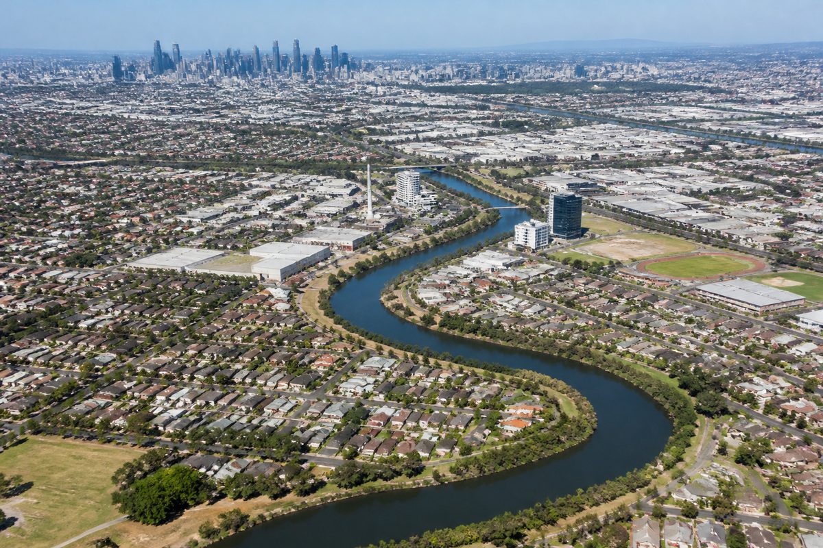
Maribyrnong is one suburb, while the City of Maribyrnong is a council area containing nine suburbs in Melbourne's west. The suburb uses the postcode 3032. The council area extends farther south and west, covering places such as Footscray, Seddon, Maidstone, Braybrook and Yarraville.
The shared name causes problems because people use “Maribyrnong” for several different areas. A property listing may mean the suburb. A council notice may mean the whole municipality. A river guide may mean the much longer waterway and its surrounding corridor. Each use points to a different boundary.
The safest rule is simple: use the suburb and postcode for an address, then check the council separately when you need local services, permits or rates.
What does “Maribyrnong” mean on an address?
On a street address, Maribyrnong means the gazetted suburb of Maribyrnong, Victoria. It is a defined locality in metropolitan Melbourne and has the Postal code 3032.
An address written as “Maribyrnong VIC 3032” does not refer to every property managed by Maribyrnong City Council. It identifies a property inside the suburb. Homes in Footscray or Braybrook can fall within the same council area while carrying different suburb names and postcodes.
This difference matters when completing forms. If a form asks for a suburb, enter the locality attached to the address. Do not replace Footscray with Maribyrnong merely because the property receives City of Maribyrnong services.
It also matters for searches. A search limited to homes for sale in Maribyrnong will usually return properties in the 3032 suburb. A search for services across the City of Maribyrnong should cover several postcodes and a much larger area.
How large is the council area compared with the suburb?
The City of Maribyrnong is a municipality within Melbourne's metropolitan system of Local government in Australia. It provides services such as local roads, waste collection, libraries, community facilities, planning and some parking controls across its municipal boundary.
The municipality contains nine named suburbs:
- Braybrook
- Footscray
- Kingsville
- Maidstone
- Maribyrnong
- Seddon
- Tottenham
- West Footscray
- Yarraville
The suburb of Maribyrnong is therefore one part of the council area. It is not another name for the entire municipality.
Think of the relationship like a folder. The City of Maribyrnong is the folder, while Maribyrnong suburb is one item inside it. The other eight suburbs remain distinct localities even though the same council serves them.
This explains why a council event advertised “for Maribyrnong residents” may be open to someone living in Seddon. In that setting, “Maribyrnong residents” means people who live anywhere within the municipality. On a delivery form, the same person must still enter Seddon as the suburb.
Where does the suburb boundary run?
The suburb sits beside a broad bend of the Maribyrnong River, which forms much of its northern and eastern edge. The river makes the boundary easy to picture on those sides. The land boundary toward Maidstone and Footscray requires more care because roads, property lines and official locality records decide where one suburb ends and another begins.
Major roads can help with orientation, but they should not replace an official address check. A business may market itself as being in Maribyrnong because it is close to Highpoint or the river, even when its registered address belongs to a nearby suburb. Large sites can also have entrances, lots or mailing details that make the location seem less clear on a simple map.
The suburb boundary does not follow the full river. The Maribyrnong River begins far beyond the municipality and passes several council areas before reaching the lower reaches near Melbourne. Living beside the river does not mean living in Maribyrnong suburb or the City of Maribyrnong.
Across the river, Ascot Vale is close enough to feel connected to Maribyrnong in daily travel. It belongs to a different suburb, postcode and municipality. This is a common source of mistakes when people judge an address by the nearest landmark or shopping area.
Which postcode belongs to each local area?
A postcode helps sort mail. It does not define a council boundary. Several suburbs can share a postcode, and one council can contain several postcodes.
The main suburb and postcode matches within the municipality are:
- Maribyrnong: 3032
- Footscray, Victoria: 3011
- Seddon, Victoria: 3011
- West Footscray: 3012
- Kingsville, Victoria: 3012
- Maidstone, Victoria: 3012
- Tottenham: 3012
- Braybrook, Victoria: 3019
- Yarraville: 3013
The pattern shows why postcode searches can mislead. Footscray and Seddon share 3011, but they are separate suburbs. West Footscray, Kingsville, Maidstone and Tottenham use 3012, yet the names still matter for addresses and local identity.
Maribyrnong's 3032 postcode is also associated with nearby localities outside the City of Maribyrnong. A postcode match alone therefore cannot prove that an address falls within a particular council.
When checking a property, read the full combination: street address, suburb, state and postcode. Then use a council boundary lookup if the task concerns rates, planning or waste services.
Why do postcode and council maps fail to match?
Postcodes and local government areas were built for different jobs. Australia Post uses postcodes to route mail. State-defined municipal boundaries decide which council governs a property. Official suburb boundaries identify named localities.
These systems often overlap, but they do not need to line up. A postcode can cross a council line. A council can manage suburbs with several postcodes. Two neighbouring suburbs can share a postcode while keeping separate names.
Consider a person moving from Maidstone to Maribyrnong. The move may stay within the same municipality, so the council remains unchanged. The suburb and postcode change from Maidstone 3012 to Maribyrnong 3032. A second move from Maribyrnong to Ascot Vale crosses the river and may change the suburb, postcode and council at once.
This is where many online forms create trouble. They may fill a suburb after the postcode is entered, but a shared postcode can produce several choices. Select the locality shown on the formal address record rather than the best-known suburb nearby.
How is Footscray related to Maribyrnong?
Footscray is a suburb within the City of Maribyrnong and serves as a major civic, transport and business centre for the municipality. It is not part of Maribyrnong suburb.
The two suburbs sit near each other, and both connect closely to the river. Their names can appear together in council material, transport advice and regional guides. That link describes proximity or shared administration, not a single locality.
A resident of Footscray may deal with Maribyrnong City Council, visit a council facility carrying the Maribyrnong name and live near the Maribyrnong River. Their postal suburb still remains Footscray, Victoria, with postcode 3011.
The distinction is useful when reporting a fault. Council responsibility may cover both areas, but the exact street and suburb help staff find the correct asset. “Maribyrnong” as a council name is too broad to locate a damaged sign, missed bin or blocked drain.
Where do Maidstone, West Footscray and Braybrook fit?
Maidstone borders Maribyrnong and shares strong road, shopping and service links with it. Yet Maidstone, Victoria is its own suburb. It uses 3012 rather than Maribyrnong's 3032.
West Footscray also sits within the City of Maribyrnong. Its name causes another common error: it is a formal suburb, not a loose description for every street west of Footscray. It uses postcode 3012.
Braybrook, Victoria lies farther west within the municipality and uses postcode 3019. A Braybrook resident can correctly say they live in the City of Maribyrnong, but putting “Maribyrnong 3032” on their mail would identify the wrong suburb.
Kingsville, Victoria follows the same rule. It is a small suburb within the council area and uses 3012. Its size does not make it part of West Footscray, Seddon or Yarraville for postal purposes.
What does the Inner West label tell you?
Inner West is a useful regional term for suburbs west of central Melbourne and relatively close to the city. It can describe shared transport links, housing markets, culture or geography. It is not a formal suburb, postcode or council.
People draw the Inner West in different ways depending on the subject. A property guide may use a tighter area than a food guide or transport study. The label can include suburbs inside the City of Maribyrnong and nearby suburbs governed by other councils.
Use Inner West when discussing a broad part of Melbourne. Do not enter it as the suburb on an address. Do not assume every place called Inner West receives services from Maribyrnong City Council.
Which boundary should you use for a practical task?
Start with the reason you need the location. Each boundary answers a different question.
- Mail and deliveries: Use the official suburb and postcode attached to the street address.
- Rates and rubbish collection: Check the municipality responsible for the property.
- Planning and building work: Confirm the council first, then check the property record and relevant planning controls.
- School enrolment: Use the school's current zone map. Council and postcode boundaries do not set every school zone.
- Property searches: Search by suburb boundary if you want Maribyrnong itself. Search across the municipality if you also want Footscray, Seddon, Maidstone and the other council suburbs.
- Emergency or service reports: Give the full street address and nearest cross street. A regional label is too broad.
A familiar place name should never overrule a formal property record. Real estate ads, business names and local speech often stretch suburb names because a nearby centre is easier to recognise. That may help with marketing, but it cannot settle council responsibility or a postal address.
How can you confirm an address without guessing?
Use a short check in the right order:
- Copy the street number and street name from the property's formal record.
- Confirm the official suburb or locality.
- Match the postcode to that suburb and address.
- Check the council's property or boundary map when municipal services are involved.
- Use the relevant agency's own map for school zones, voting districts or utility service areas.
Do not rely on a map pin alone. Pins can sit near a boundary, use a business entrance or display the better-known suburb next door. Do not rely on the postcode alone either, since several localities may share it.
The single actionable takeaway is this: treat “Maribyrnong,” “City of Maribyrnong” and “Maribyrnong River” as separate location clues, then verify the full address before using any boundary, postcode or council service.