The History of Maribyrnong: from Industry to Riverside Neighbourhoods
Explore the history of Maribyrnong: from industry to riverside neighbourhoods, tracing factories, workers, land renewal and life beside the river.
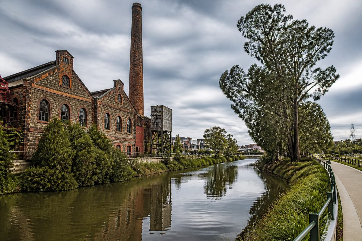
Maribyrnong changed from an industrial district into a group of riverside neighbourhoods as factories closed, contaminated land was reused, and the river became a place for homes and recreation. The change took more than a century. Meat works, quarries, explosives stores, engineering plants and defence factories once shaped local jobs and streets. Their decline opened large sites for housing, parks and paths, but it also left pollution and heritage questions that still affect development.
The history of Maribyrnong is written into the land. A river bend can hold an Aboriginal cultural place, a former factory wall, a shared trail and new apartments within a short walk. Understanding those layers explains why the area looks different from inner suburbs built mainly around shops and houses.
Why did settlement grow beside the river?
The Maribyrnong River supplied water, fertile flats and a natural travel route long before factories arrived. The district lies on Aboriginal Country, including places described as Wurundjeri Woi-wurrung Country. Traditional Custodians used the river corridor for food, movement, ceremony and social life. Its banks were part of a living cultural system rather than empty land waiting for settlement.
British colonisation disrupted that system through land seizure, farming, fences and pollution. European settlers first called the waterway the Saltwater River because tidal water travelled upstream from the Yarra. The name Maribyrnong came into official use in the early twentieth century, though the origin and meaning of the word have been interpreted in different ways.
The waterway later drew industries that needed large sites, water access or distance from central Melbourne. River flats offered room for yards and sheds. Nearby quarries supplied stone and basalt. Roads, rail lines and the Port of Melbourne linked local plants with customers and suppliers. Those practical advantages set the pattern for industrial growth across Maribyrnong, Victoria.
What kinds of industry defined early Maribyrnong?
Meat processing became one of the district's first major industrial activities. The Melbourne Meat Preserving Company opened beside the river in the 1860s. It processed livestock on a scale that small local businesses could not match. The site later became part of Pipemakers Park, where surviving structures preserve traces of its industrial use.
Explosives and ammunition also shaped the area. Jack's Magazine, built in the nineteenth century, stored gunpowder away from dense central streets. Its thick walls, separate storage spaces and protected position reflected the danger of its contents. Ammunition and defence production later expanded around Maribyrnong, creating a large employment zone that served Australia during periods of war and military growth.
Other businesses made pipes, chemicals, machinery and building materials. Quarrying cut into the volcanic ground. These activities changed the riverbank through excavation, waste disposal and new transport links. Smoke, noise and industrial smells were normal parts of local life.
The factories also created stable wages for many households. Migrants and local families settled near their jobs because daily travel was slower and more costly than it is now. Rows of modest houses, corner shops and worker services grew around the plants. Industry was therefore more than a collection of buildings. It determined where people lived, when streets became busy and how household income moved through the district.
How did factory work shape nearby neighbourhoods?
The industrial economy reached well beyond the present suburb of Maribyrnong. Footscray, Victoria became a major centre for manufacturing, trade and rail transport. West Footscray developed around workshops, factories and homes within reach of employment. Seddon, Victoria also housed workers who relied on nearby industrial areas and Footscray's commercial services.
This produced a strong working class identity across Melbourne's Inner West. People often worked close to home, shopped on familiar streets and joined local clubs or unions. Shift changes could fill roads, trams and railway platforms at set times. A factory closure could affect a whole shopping strip because hundreds of workers lost wages at once.
Industrial work could be hard and unsafe. Machinery, chemicals, dust and heavy loads exposed workers to risks that would face tighter controls today. River pollution was often treated as a cost of production. Waste entered drains or settled in soil because the long-term harm was poorly controlled or ignored.
Yet residents did not see their neighbourhoods as simple industrial zones. They built family lives around schools, sports grounds, places of worship and local shops. That social fabric survived many factory closures. It helps explain why renewal works best when it keeps useful old buildings and community spaces instead of clearing every trace of the past.
Why did the industrial era begin to fade?
Manufacturing declined across inner Melbourne during the late twentieth century. Plants needed modern equipment, cheaper operating sites or better truck access. Some firms moved to outer industrial estates, while others closed due to foreign competition and changes in production. Defence operations were also reduced or reorganised.
Maribyrnong had large industrial properties close to the city, but many were no longer suited to modern factories. Their riverfront locations had once been useful working edges. As public interest in waterways grew, the same land became attractive for parks, trails and housing.
This change did not happen in one clean break. Industry, vacant land and new homes existed side by side for years. Some residents lost secure jobs. Small businesses lost customers. Empty sites became barriers between streets and the river. Renewal brought new value, but it also changed who could afford to live nearby.
The shift is easy to misunderstand as a simple move from dirty industry to pleasant housing. In practice, it involved job loss, planning disputes, costly land repair and arguments about heritage. The riverfront became desirable partly because generations of industrial workers had already built the roads, services and communities around it.
What happened to the old factory sites?
Many former industrial properties became Brownfield land. This means land that has been used before and may face barriers to reuse, including pollution, unsafe structures or buried waste. A cleared site can look harmless while contaminated soil remains below the surface.
Redeveloping such land requires testing, risk assessment and treatment suited to its next use. Soil may be removed, sealed below clean material or managed under strict controls. Groundwater can also need monitoring. A standard safe enough for an operating factory may not be safe enough for homes, gardens or childcare.
The former defence land at Maribyrnong shows why this process can take years. Large sites may contain several types of contamination from different periods of use. They can also contain heritage buildings, habitat and places of Aboriginal cultural value. Planning must deal with all these layers before streets and homes can be built.
Successful reuse keeps evidence of what happened on the site. Pipemakers Park does this through retained industrial structures, open space and interpretation. Jack's Magazine survives as a rare place connected with explosives storage. Such sites give physical form to history. Without them, the industrial period can shrink into a few names on apartment buildings.
How did the Maribyrnong River become a public place?
For much of the industrial period, parts of the river were treated as working land or a drain behind factories. Fences and private sites blocked access. Poor water quality reduced its appeal for recreation. As factories closed, public agencies and community groups began to reclaim sections of the bank for parks, paths and habitat.
Shared trails now link neighbourhoods that industrial properties once separated from the water. Parks provide room for walking, cycling, sport and quiet use. Homes face the river instead of turning their backs on it. This change has made the waterway a daily part of local life again.
Ecological restoration has supported that shift. Projects along the corridor have removed weeds, planted native species, stabilised banks and improved habitat. Wetlands and planted edges can slow runoff before it reaches the river. These works cannot erase more than a century of damage, but they can rebuild useful habitat and make the banks more resilient.
Flooding remains part of the river's natural behaviour. Industrial yards could tolerate some risks that homes cannot. New development must account for flood levels, drainage and safe access. A river view does not cancel the need to respect the floodplain.
How did riverside renewal change daily life?
New housing brought more residents within a short trip of central Melbourne. Apartments and townhouses appeared on former industrial or low-use sites. Cafes, services and recreation followed growing demand. Connections between Maribyrnong and nearby Footscray became part of a broader move toward inner-city living.
The change also created pressure. More homes meant more cars on roads that had developed around factories and older housing. Public transport did not always grow at the same pace. River paths became busier, while popular parks had to serve residents from a wider area.
Housing costs rose as buyers began to value water views, park access and proximity to the city. That created a sharp contrast with the area's working class past. Long-term renters and lower-income households could find themselves priced out of neighbourhoods their families had helped build.
One lesson from comparable renewal areas is clear: a new park does not make a complete community. Residents also need schools, public transport, local shops, shade and safe walking routes. When planning focuses on dwelling numbers alone, daily life becomes harder even when the buildings look polished.
What parts of the old Maribyrnong can still be seen?
The strongest evidence appears where buildings, landforms and street patterns survive together. Pipemakers Park contains structures linked to meat processing and pipe production. Jack's Magazine records the handling of explosives. Former defence land preserves the scale of government manufacturing, even where access is limited or future use remains under review.
Quarrying can be read in altered ground levels and steep edges. Workers' cottages and compact streets show how families lived near jobs. Rail corridors, bridges and wide industrial roads reveal how materials moved through the district. Even gaps in the urban pattern can mark sites where a large plant once stood.
Names also carry history, but names alone can soften what happened. A development may borrow a factory name while removing every useful trace of the factory. Good heritage work keeps enough physical evidence to show the site's former scale, purpose and effect on workers.
The river itself remains the clearest thread. It supported Aboriginal life, drew colonial industry, received industrial waste and later became the focus of public renewal. Each period changed the waterway, but none fully replaced the layers that came before it.
What does this history reveal about the neighbourhoods today?
Maribyrnong's riverside identity rests on an industrial base. Parks occupy former work sites. Trails cross land once closed to the public. New homes depend on the cleanup of ground used by earlier industries. Local character comes from this overlap, not from a complete break with the past.
The history also explains current debates. Residents question building height because redevelopment changes views and street pressure. They ask about soil because contamination can remain hidden. They defend old structures because too much demolition can strip a place of meaning. They seek better transport because a factory district and a dense residential district move people in different ways.
Maribyrnong is therefore best understood as a reused place. Its renewal has produced real gains, including river access and new housing. It has also passed costs between generations. Industrial employers created jobs while leaving damaged land. Redevelopment repairs some of that damage while raising new concerns about density, affordability and public services.
How should you explore Maribyrnong's history?
Walk one connected route from Pipemakers Park to the river trail and Jack's Magazine, and read the surviving buildings, bank works and street layout as parts of the same story.