What Is Maribyrnong Known for? a Guide to the Suburb’s Character and Landmarks
What is Maribyrnong known for? Discover its river, industrial landmarks, shopping, heritage sites and the local character of this Melbourne suburb.
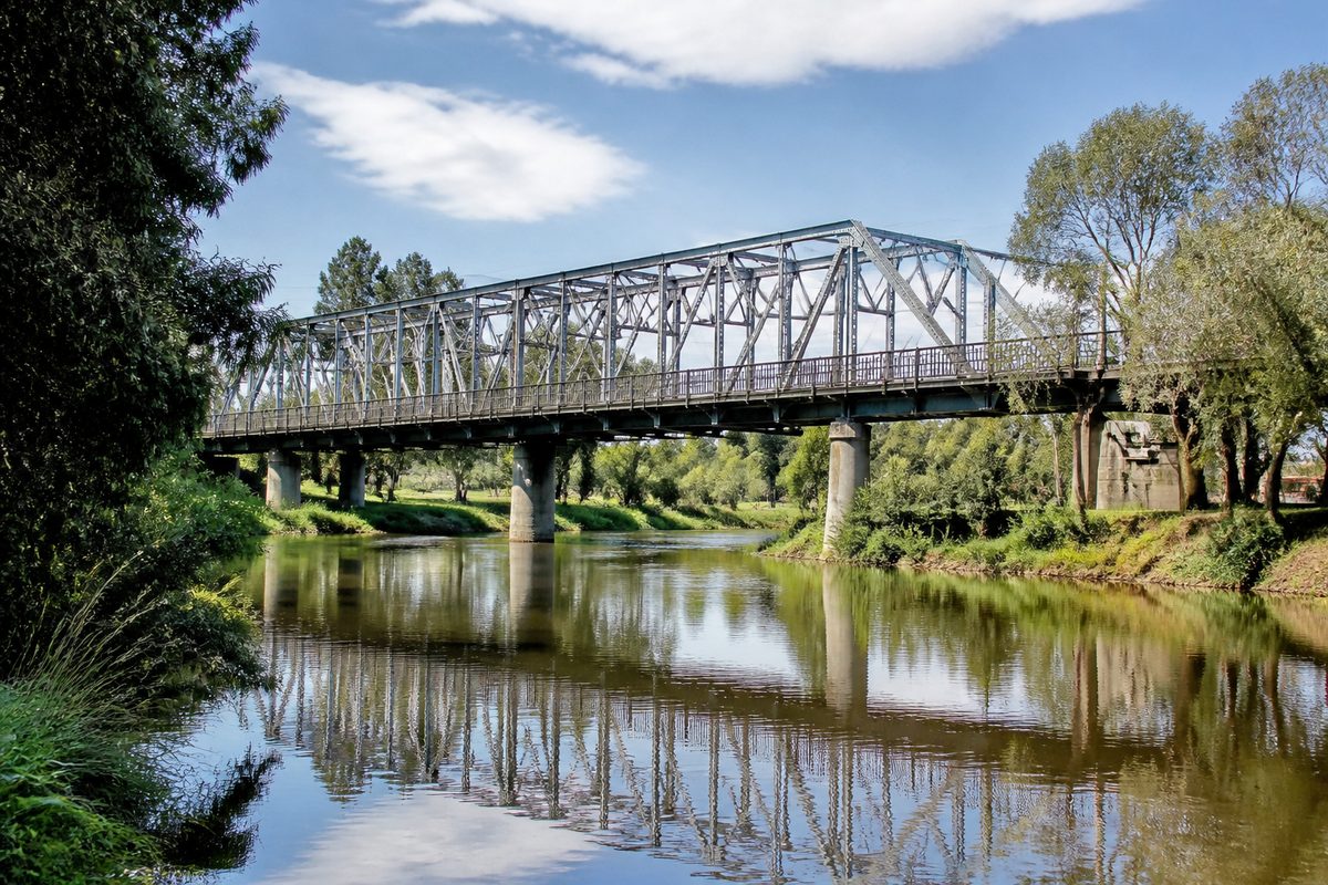
Maribyrnong is best known for its river, major shopping precinct, defence history and mix of old industrial sites with newer riverside homes. The suburb feels different from much of Melbourne because these parts sit close together. A walk can take you from a busy retail district to a quiet river trail, then past land once used to make or store explosives.
That mix gives Maribyrnong, Victoria a clear identity. It is part of Melbourne’s Inner West, about eight kilometres from the city centre, yet it does not feel like an extension of the central business district. The river bends around much of the suburb and sets its pace. Highpoint draws visitors from across Melbourne, while places such as Pipemakers Park and Jack's Magazine reveal stories that are easy to miss from the main roads.
How does the river shape Maribyrnong’s character?
The Maribyrnong River is the suburb’s strongest natural feature. It forms much of the local boundary and gives residents open space in an area once shaped by heavy industry. Shared trails follow the water past parks, sports grounds, wetlands and former work sites. People use these paths for walking, cycling and running, but the river does more than provide a place to exercise. It connects the suburb’s natural setting to its Aboriginal and industrial history.
The river was called Saltwater River by European settlers until 1913. Its present name comes from an Aboriginal word, though historical records offer different meanings and spellings. That uncertainty matters. Aboriginal place names were often recorded by settlers who did not understand the language or its sounds. A neat English translation can hide that loss.
The waterway sits within the traditional Country of the Wurundjeri Woi Wurrung people. The Wurundjeri Woi Wurrung Cultural Heritage Aboriginal Corporation is the recognised body that represents Wurundjeri Woi Wurrung people in matters tied to Country and Cultural heritage. This living connection reaches far beyond plaques or archaeological finds. The river was part of travel, food gathering, ceremony and social life long before factories appeared on its banks.
Visitors often expect an urban river to feel like a narrow drain between roads. Here, long bends create wider views and pockets of calm. The best way to understand the suburb is to follow one of those bends on foot. The sound and scale of the roads fade, while old structures begin to make sense as parts of a river-based working district.
Why is Highpoint such a large part of the suburb’s identity?
Highpoint Shopping Centre is one of Melbourne’s largest retail destinations. It has department stores, supermarkets, cinemas, dining areas and a broad range of specialty shops. Many people who say they are going to Maribyrnong mean they are going to Highpoint.
The centre affects how the suburb moves. Traffic grows around Rosamond Road and nearby routes during busy shopping periods. Bus services link the complex with surrounding suburbs and railway stations, while large parking areas serve visitors arriving by car. For locals, Highpoint can handle routine errands and major purchases in one place.
Calling it a shopping center tells only part of the story. Highpoint also acts as a meeting place for Melbourne’s western suburbs. Teenagers meet friends there. Families combine shopping with a meal or film. Older residents use its indoor spaces when heat, rain or limited mobility make outdoor strips harder to manage.
Its scale can distort a first visit. Highpoint is prominent, but Maribyrnong is not simply a retail suburb. The quieter residential streets north and east of the complex have a different rhythm. The river corridor feels different again. Seeing only the centre means missing the feature that gives the suburb its name and much of its history.
Where can you see Maribyrnong’s industrial past?
Pipemakers Park is the clearest place to read Maribyrnong’s Industrial heritage. Pipes and other concrete products were made on this riverfront land during the twentieth century. Earlier uses included meat preserving and boiling-down works. Parts of the former factory remain, so the park does not erase the site’s working past.
This is what makes the place useful. Old walls, kilns and industrial forms sit near lawns, paths and garden areas. The contrast shows how land use changed without turning the whole site into a blank park. Visitors can see that the river once served production and transport as well as recreation.
The Living Museum of the West grew from efforts to record the lives of people in Melbourne’s western suburbs. Its work has included oral histories, community records and stories about migration, labour and industry. That approach treats workers and residents as historical sources. Factory output matters, but so do the people who handled the machinery, lived near the river and adapted as jobs disappeared.
In my experience, industrial ruins make more sense when you look for practical details. Notice the thickness of a wall, the position of a building beside the water or the space once needed to move heavy goods. Those clues turn an old structure into evidence of how the site worked.
What is Jack's Magazine, and why was it built here?
Jack's Magazine is a former explosives storage complex near the Maribyrnong River. Its heavy bluestone buildings, earth mounds and separated storage areas were designed to limit damage if gunpowder caught fire or exploded. The site is one of the suburb’s most striking heritage places because its form still reveals its purpose.
The magazine was developed in the nineteenth century when Melbourne needed a safer place to store imported gunpowder. Its river position helped move dangerous goods away from crowded central areas. Thick walls offered protection, while spacing and defensive earthworks reduced the chance that one blast would set off the whole complex.
The name can confuse visitors. A magazine in this setting is a building or compound used to store ammunition or explosives. It has no link to printed publications. The familiar name is tied to local usage and the site’s later history.
Access conditions have changed at different times, so visitors should check current opening information before planning to enter. Even when viewed from surrounding public areas, the complex adds a fortress-like form to the river corridor. It also explains why defence and explosives work became so closely tied to Maribyrnong.
How did defence work change the suburb?
The Defence Explosive Factory and related government facilities turned Maribyrnong into a major centre for military production and research. Large areas near the river were used for ammunition, explosives and defence work. These sites provided jobs, but they also restricted public access and separated parts of the suburb from the water.
Defence work left a complex local memory. For some families, it meant steady wages and skills passed between generations. For the suburb, it meant fenced land, dangerous materials and later questions about clean-up. Both sides belong in the story. Industrial employment supported households, while the same activity created costs that remained after production slowed or stopped.
The physical pattern is still visible. Secure compounds needed distance from homes and from each other. Roads and buildings followed the needs of production rather than a normal residential street plan. When those uses ended, planners faced large parcels of land that could not simply be opened and built on at once.
What has urban renewal changed along the river?
Urban renewal replaced several former industrial or defence uses with housing, paths and public spaces. The Edgewater development is the best-known local example. Apartments, townhouses, shops and landscaped areas now occupy land near the river that had a very different purpose.
The change brought more residents close to the water and improved access to parts of the riverbank. It also gave Maribyrnong a newer visual identity. Modern apartment blocks now appear beside old industrial structures and established detached homes.
That shift created trade-offs. More housing near services can make good use of inner urban land. Yet new development can weaken a place’s identity if every trace of earlier use is removed. Maribyrnong works best where old structures, records and public interpretation remain visible. They let residents understand why the land looks as it does.
Former industrial ground may also require testing and clean-up before a new use begins. This is one of the less visible parts of renewal. Fresh paving and new gardens can make a site look settled, while years of assessment sit behind the finished result. The suburb’s newer riverfront areas make more sense when viewed as converted work land rather than ordinary housing estates.
How is the suburb different from nearby Footscray?
Maribyrnong is often grouped with Footscray, Victoria because both sit in Melbourne’s west and share strong working-class and industrial histories. Their street life feels different. Footscray has a dense town centre built around its railway station, markets and busy shopping streets. Maribyrnong has no comparable rail hub within the suburb.
Maribyrnong is more spread out. Highpoint serves as its main commercial draw, while the river and former industrial land break up the street grid. Residential pockets can feel quiet even when a major road or retail complex is close by.
The two places still connect through work, transport, migration and shared public life. Footscray often supplies the faster, denser urban experience. Maribyrnong offers longer river paths, larger former industrial sites and a retail centre built for a wide regional catchment. Knowing that difference helps visitors choose where to spend their time.
What does everyday life in Maribyrnong feel like?
Daily life changes from one part of the suburb to another. Near Highpoint, traffic and retail activity set the pace. Around Edgewater, newer homes face paths and open space. Near older streets, weatherboard houses and postwar buildings show earlier stages of growth.
The river gives the suburb a shared outdoor focus. A resident can use the trail for a short walk, continue toward neighbouring suburbs or stop near one of the parks along the water. Sporting grounds and playgrounds make the corridor useful rather than decorative.
Transport is a practical issue. Buses and nearby tram routes serve the area, but many trips rely on connections to railway stations outside the suburb. Driving can be convenient until retail traffic peaks. A visitor planning several stops should allow time for the gaps between them.
The suburb’s character comes from contrast. Large-scale shopping sits near local streets. New housing overlooks land once closed for industry. River vegetation grows beside structures made for hard, risky work. These contrasts are not separate themes. Together, they explain why Maribyrnong feels distinct within the Inner West.
Which landmarks best explain Maribyrnong in one visit?
A useful visit should follow the suburb’s main idea: the river connects Country, industry and present-day life. Begin near Pipemakers Park, where surviving structures reveal how the riverfront was used for production. Read any site signs slowly, since small details often explain the purpose of buildings that now appear incomplete.
Continue along the Maribyrnong River trail toward the area around Jack's Magazine. Check access rules before the trip if you hope to enter a heritage site. From the public path, pay attention to how walls, earth banks and distance were used for safety.
After the river, visit Highpoint Shopping Centre to see the modern regional role of the suburb. The change in scale is sharp. The quiet waterway and guarded industrial sites give way to a busy indoor centre built around retail and leisure.
If time allows, compare the newer Edgewater streets with an older residential pocket. The difference shows how Maribyrnong has absorbed population growth while retaining fragments of its earlier form.
What do most quick guides miss about Maribyrnong?
Many guides treat the river, Highpoint and heritage sites as separate attractions. They are parts of the same story. The river drew Aboriginal life and later industry. Industry led to defence compounds and restricted land. The end of those uses opened space for parks, housing and public paths. Highpoint then strengthened Maribyrnong’s role as a destination for the wider west.
Another missed point is that heritage here is not limited to attractive old buildings. It includes contaminated land, worker memories, changed river conditions and Aboriginal knowledge that predates the suburb itself. A complete view must account for who used the land, who lost access to it and how its use changed.
Walk the river corridor from Pipemakers Park toward Jack's Magazine, then finish at Highpoint, because that route gives the clearest single view of what Maribyrnong is known for.